African Mountain Climbing For Beginners & Trekking Expeditions
African Mountain Climbing For Beginners and friendly-guided Trekking Expeditions. Africa provides countless opportunities for highland trekking and mountain climbing. From leisurely strolls through the gentle hills of South Africa’s Drakensburg heights to trekking on Mount Kenya’s slopes, or extreme endurance tests such as scaling the world’s most famous mountain, Mount Kilimanjaro, the “Shining Mountain” capped in glaciers that rises 5895 meters above the rolling plains of northern Tanzania, there are endless options available.
It is important to remember that this is the world’s tallest isolated peak. Even if there are several pathways that represent varying degrees of skill and stamina, climbing the mountain is a strenuous task that carries a genuine risk to one’s life.
African Mountain Climbing Adventures/Expeditions
Rwenzori Trekking Experts & Kilimanjaro Trekking Experts is a team collaboration between The Bespoke African Safari Co. and a well-respected family business with over thirty years of familiarity with this mountain. While specialized mountain climbing skills or mountaineering equipment are not necessary for this challenging vacation on Africa’s highest peak, you will require the expertise of a knowledgeable support crew. This mountain is the culmination of many people’s wildest dreams of dangerous adventure on this stunning continent.
The best places to go hiking in Africa, how to climb African mountains, and other helpful information. Mountain Climbing Destinations in Africa
Highest AFRICAN Mountain Peaks To Visit
Highest Mountains in Africa
The dormant volcano in Tanzania known as Mount Kilimanjaro stands at 5,895 meters (19,341 feet) above sea level and is the tallest peak in Africa. Its three volcanic cones are Shira, Kibo, and Mawenzi. Other tallest African mountains are listed below.
Pictured in your mind’s eye are the Serengeti’s undulating plains and savannas and the Sahara’s sweltering desert. It turns out that Africa is home to some of the world’s most breathtaking mountain ranges, including several that can hold their own against the likes of the Swiss Alps, the Rocky Mountains (with their sharp, snow-capped peaks), and even Mount Everest (when it comes to mountaineering prestige).
While some of the top ten mountains in our list formed as volcanic eruptions, others are the product of tectonic plate breaks. Climbing some requires little more than a day’s supply of supplies and a little bit of willpower, while others demand specialized gear and years of climbing expertise.
Some are located in locations that have been devastated by war and are still experiencing political unrest. Everyone has an interesting tale to share.
There is some reasonable misunderstanding on the application of certain words before we begin. Words like “peak” and “summit” appear to be used pretty freely to mean “mountain” when it comes to this situation.
In the sake of geological precision, nevertheless, these words are separate and have different meanings:
- Mountain – A landform that rises more than a thousand feet (300 meters) above the ground level in its immediate vicinity.
- Peak – A mountaintop that is higher than all of the surrounding locations (you were standing on one of these before you started to descend; that’s one way of looking at it). It is not uncommon for a mountain to have several peaks.
- Summit – At the very top of a mountain. Although not all peaks are summits, every peak is also a summit.
In addition, there are other approaches to categorizing mountains according to their height. The classification of mountains is sometimes neglected in favor of sheer altitude while compiling these rankings. Regarding this matter, the following is a list that ranks real mountains according to their prominence, which is defined as the distance from the peak to the lowest nearby terrain, and it must be at least 1,300 feet (or 400 meters).
Mount Kilimanjaro
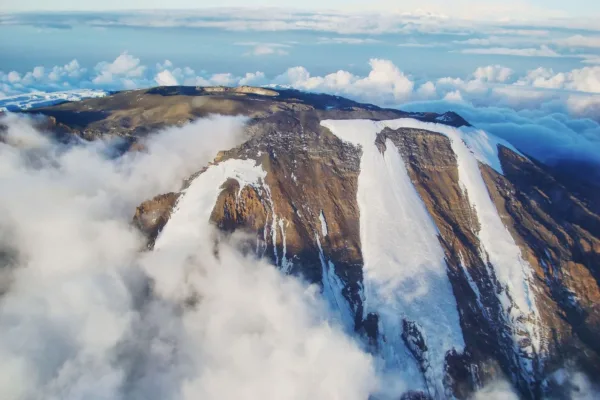
Located in Tanzania’s Kilimanjaro Region, 5,895 meters (19,341 feet) tall Mount Kilimanjaro stands at the fourth most prominent mountain in the country and is 3,420 miles (3,510 kilometers) from any other point. Stratovolcanoes like this one last erupted anywhere from 150,000 to 200,000 years ago. The three volcanic cones of this mountain—Mawenzi, Shira, and Kibo—make it one of Tanzania’s most prominent volcanoes. From its base, Kilimanjaro Mountain rises more than 4,900 meters (16,000 feet), making it the highest mountain in Africa. The first people to reach the peak were Hans Meyer and Ludwig Purtscheller in 1889. As the most popular climbing site in East Africa, this world-renowned mountain is located within Kilimanjaro National Park.
Mount Kenya
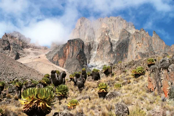
After Africa’s tallest peak, Kilimanjaro, this mountain ranks second in Kenya in terms of elevation. Point Lenana (4,985m/16,355ft), Batian (5,199m/17,057ft), and Nelion (5188m/17,021ft) are its tallest points. In the middle of Kenya, not far from the Equator and 150 kilometers northeast of Nairobi, the country’s capital, lies this mountain. Another moniker that the Republic of Kenya takes from this mountain is Mount Kenya. Additionally, it is a stratovolcano that formed three million years ago. Over its many years of existence, the mountain’s ice cap has kept it at an altitude of more than 7,000 meters (23,000 feet) above sea level. A significant source of water for many regions of Kenya, its eleven tiny glaciers and wooded slopes play an essential role. Lobelias, rock hyrax, and senecious are among the numerous plant species that blanket the mountainside. In 1997, a portion of its area—715 km—was established as a national park and added to the UNESCO World Heritage List. This park is known as Mount Kenya National Park.
Mount Rwenzori
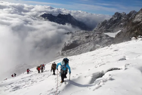
Located on the boundary between the Democratic Republic of the Congo and Uganda, the Rwenzori Mountains (also known as the Ruwenzori Ranges) are a mountain range in eastern equatorial Africa. Mount Kilimanjaro and Mount Kenya both have snow on their highest points, which are 5,109 meters (16,762 feet) above sea level. Rwenzori and Virunga National Parks are both located on the mountain. An uplifted block of crystalline rocks, including amphibolite, granite, gneiss, and quartite, formed this mountain three million years ago, in the late Pliocene epoch.
Atlas Mountains Morocco
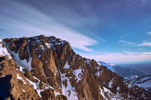
Another mountain range in the Maghreb is the Atlas Mountains. It passes through Algeria, Tunisia, and Morocco, and reaches a total of about 2,500 km (1,600 mi). Located in southwestern Morocco, this mountain range is topped by Jebel Toubkal, which stands at an impressive 4,167 meters (13,671 feet) above sea level. The mountains separate the world-famous Sahara desert from the Mediterranean and Atlantic coasts. The Berber people make up the majority of the mountain inhabitants. The region is home to a wide array of flora and fauna that are in risk of extinction. Among these are the atlas mountain viper, Cuvier’s gazelle, north African elephant, sheep, stags, leopards, lions, atlas macaques, and many more.
Semien Mountains of Ethiopia
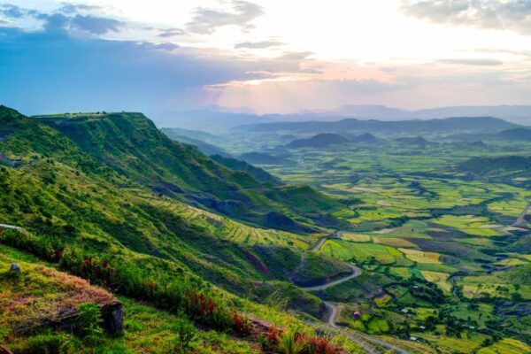
Part of the vast Ethiopian Highlands, the Semien Mountains are situated in northern Ethiopia, to the northeast of Gondar. Among these is the Semien National Park, which is a World Heritage Site. The valleys and the ascent to the summits divide the plateaux that make up this unusual mountain. Ras Dashen stands at 4,550 meters, with Kidis Yared at 4,453 meters and Biuat at 4,437 meters being the next two tallest points. Gelada, caracal, walia ibex, and Ethiopian wolves are among the animal species that can be found here. It is said that these African mountains are a fantastic place to go skiing even if it never snows there. Henry Salt was the second person after a Jesuit priest to experience this snow.
The Drakensberg South Africa
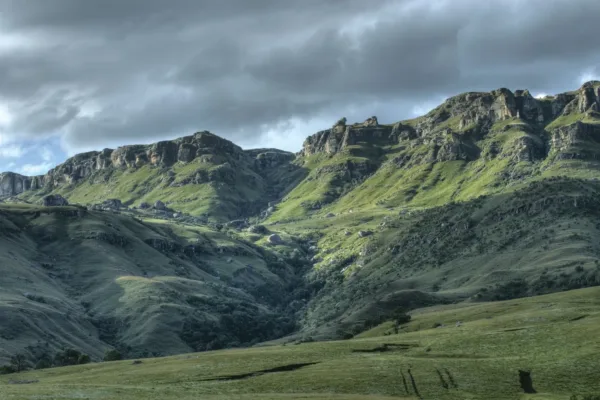
The eastern part of the enormous Escarpments, which encompasses the plateau in southern Africa, is referred to as the Drakensberg. With an elevation of 2,000 to 3,000 meters, the escarpment forms a natural border between Lesotho and the Eastern Cape, and it stretches for more than 1,000 kilometers (600 miles) from the province of Eastern Cape in the south to the province of KwaZulu Natal in the north. With an elevation of about 11,400 feet (3,475 meters), this mountain range is also the most prominent in South Africa. Artwork on rocks and in caves has been discovered throughout the range for a number of years. It is a UNESCO World Heritage Site with numerous parks and game reserves. Not only that, but it supplies water to the Orange River and is the primary watershed in South Africa. Among the many peaks found on this mountain range are Thabana Ntlenyana, which stands at 3,482 meters (11,424 feet) above sea level, Makoaneng, Mafadi, Njesuthi, Giant’s Castle, Champagne castle, popple peak, Ben Macdhui, and Champagne castle.
Mount Meru of Tanzania
Just 70 kilometers (43 miles) west of Tanzania’s Mount Kilimanjaro lies another dormant stratovolcano, Mount Meru. On a clear day, it may be seen from Mount Kilimanjaro, thanks to its elevation of 4,562.13 meters, or 14,968 feet. As far as anyone knows, it’s the tallest mountain in Africa. Numerous bouts of volcanic activity are seen in the mountain’s numerous tiny cones and craters, the most recent of which occurred in 1910 during a modest eruption. The forest that grows on top of the savannah grassland is home to a wide range of animals, including 400 different kinds of birds, leopards, and monkeys. Up until recently, the sole and primary path to the peak was the 4-kilometer-long Momella path. Beginning from the Momella gate (1,500m), the route follows two tracks: the one leading to Miriakamba Hut (2,514m/8,250ft) and the other leading to saddle Hut (3,566m/11,700ft). From Rhino Point, you can see the inner crater walls and the top in all their breathtaking glory. Because of its high elevation and long hiking distances, the ascent to this mountain is a perfect acclimatization for the famous Mount Kilimanjaro. In addition to the difficult climb, the trail is ideal for hikers who would rather avoid crowds.
Mount Elgon, Uganda & Kenya
In the Mount Elgon National Park, on the Kenyan and Ugandan borders, north of Kisumu, and west of Kitale, is the extinct shield volcano Mount Elgon. Located in Uganda, the mountain is crowned with the Wagagai peak. This mountain ranks sixteenth among Africa’s highest, with an elevation of 4,321 meters (14,77 feet) above sea level. This mountain is the oldest extinct volcano in East Africa, dating back 24 million years. Around 3,500 sq km (1,400 sq mi) is the area covered by this mountain as well. Additionally, it is recognized as a single volcanic peak that borders both eastern Uganda and western Kenya. Above the surrounding plains, the mountain soars more than 3,070 meters, and its diameter is 80 kilometers. The higher altitude offers comfort to flora and fauna, while the cooler heights provide relief to humans from the sweltering plains below.
Mount Cameroon
Located close to the Gulf of Guinea border, Mount Cameroon is an active volcano in Cameroon. The two peaks of the mountain are known as Fako, and it is also known by its native name, Mongo ma Ndemi, or Cameroon Mountain. Located in central and western sub-Saharan Africa, it is the highest peak in the region. This mountain ranks 31st in the world and is the most conspicuous summit in Africa. The peak, which is one of Africa’s greatest volcanoes, juts out 4,040 meters (13,255 feet) over the West Cameroon shore. Starting in a tropical rain forest on the coast, it climbs to a barren peak that is chilly, windy, and occasionally flecked with snow. It takes hikers about four and a half hours to reach the mountain’s peak, and the Mount Cameroon Race of Hope takes about the same amount of time. In 1897, Mary Kingsley was the first to reach the peak of the mountain.
Mulanje Mountain Malawi
The largest manadnock in southern Malawi, Mulanje Massif (also spelled “Mount Mulanje”) rises from the tea-growing Mulanje area and the nearby plains of Chiradzulu, 65 kilometers east of Blantyre. At its peak, Sapitwa, the mountain reaches an elevation of 3,002 meters and measures 13×16 miles or 22×26 km in circumference. At an elevation of 1800-2200m, the mountain is mostly grassland. Not only that, it has the longest rock climb in Africa, Chumbe Peak, among its many summits. In 1859, David Livingstone was the first to see the peak of the mountain. The mountain is too tall, which causes it to obstruct the movement of air at higher altitudes and even the formation of rain clouds.


